The process of purchasing a home has shifted dramatically. Where buyers once spent countless weekends driving from open house to open house, the initial vetting process has moved almost entirely online. Modern technology allows prospective homeowners to conduct a deep analysis of a property get a feel before they ever step foot on the driveway.
This shift isn’t just about convenience; it is about data efficiency. By leveraging digital tools, buyers can filter out unsuitable properties quickly, saving time and focusing their energy on homes that truly meet their criteria. Here is how you can effectively gauge the fit of a property from a distance.
How accurate are 3D virtual tours compared to physical visits?
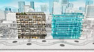
3D walkthrough technology has become a standard in professional real estate listings. Unlike static photography, which can sometimes distort the perception of depth or size using wide-angle lenses, immersive 3D tours offer a realistic sense of scale and flow.
These tools allow you to navigate the home room by room, providing a clear understanding of the layout. You can check lines of sight—such as what you see from the kitchen island looking into the living room—which is crucial for understanding how a family might inhabit the space. While it does not replace the final physical inspection, it is the most reliable method for assessing spatial relationships remotely.
Can you effectively assess a neighborhood without driving through it?
Assessing the surrounding area is just as important as evaluating the structure itself. Fortunately, satellite imagery and street-level mapping provide comprehensive data on the neighborhood environment.
Buyers can use these tools to virtually “walk” the streets, checking for the condition of neighboring properties, the presence of sidewalks, and proximity to busy roads or commercial zones. Furthermore, online data aggregators provide granular details regarding local school ratings, crime statistics, and walkability scores. By analyzing this data, you can build a risk profile of the location without needing to be physically present.
What role do detailed floor plans play in remote evaluation?
While photos show finish and style, floor plans show function. A listing that includes a detailed floor plan with measurements is invaluable for remote buyers. This document allows you to visualize furniture placement and determine if the square footage is usable or wasted in hallways and awkward corners.
Analyzing the floor plan helps verify if the home meets specific functional needs, such as a home office space or a ground-floor bedroom, which might not be immediately obvious in a photo gallery.
How can buyers verify the condition of the property remotely?
High-definition video calls with a trusted real estate agent are the final piece of the remote puzzle. An agent can act as your eyes and ears, walking through the property in real-time.
During these calls, ask the agent to focus on details that cameras often hide, such as the age of the appliances, the condition of the flooring, or ambient noise levels from the street. This live interaction provides the sensory details—like the sound of the HVAC system or the water pressure—that static digital assets cannot convey.
Making the Final Decision
Getting a feel for real estate remotely is about aggregating data points. By combining immersive tours, neighborhood analytics, and precise documentation like floor plans, buyers can make informed decisions with a high degree of confidence. This digital-first approach ensures that when you finally visit a home in person, it is simply to confirm what you already know.